The World Map of Climate Tipping Points
Worksheet / Foldable Globe / Augmented Reality
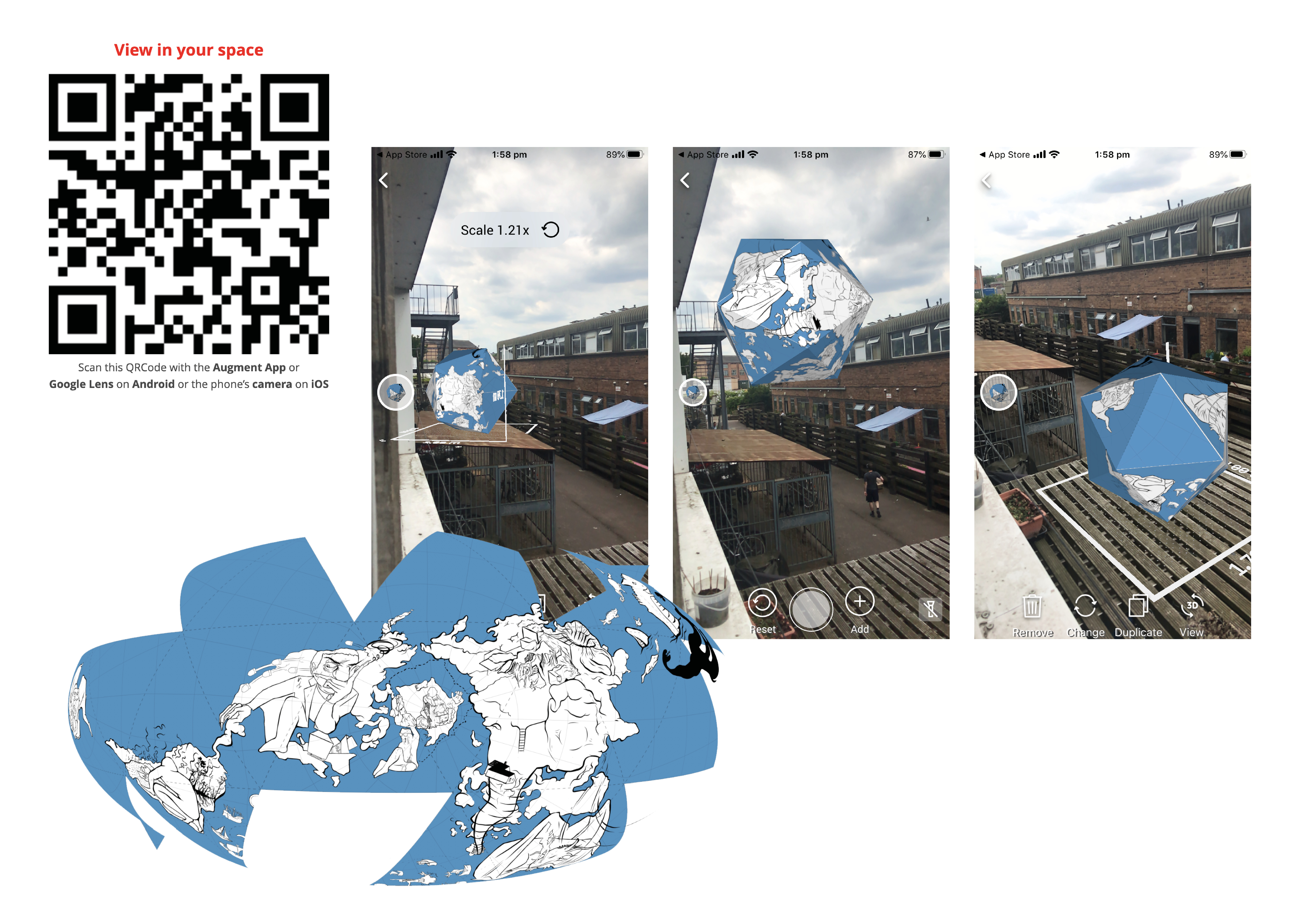
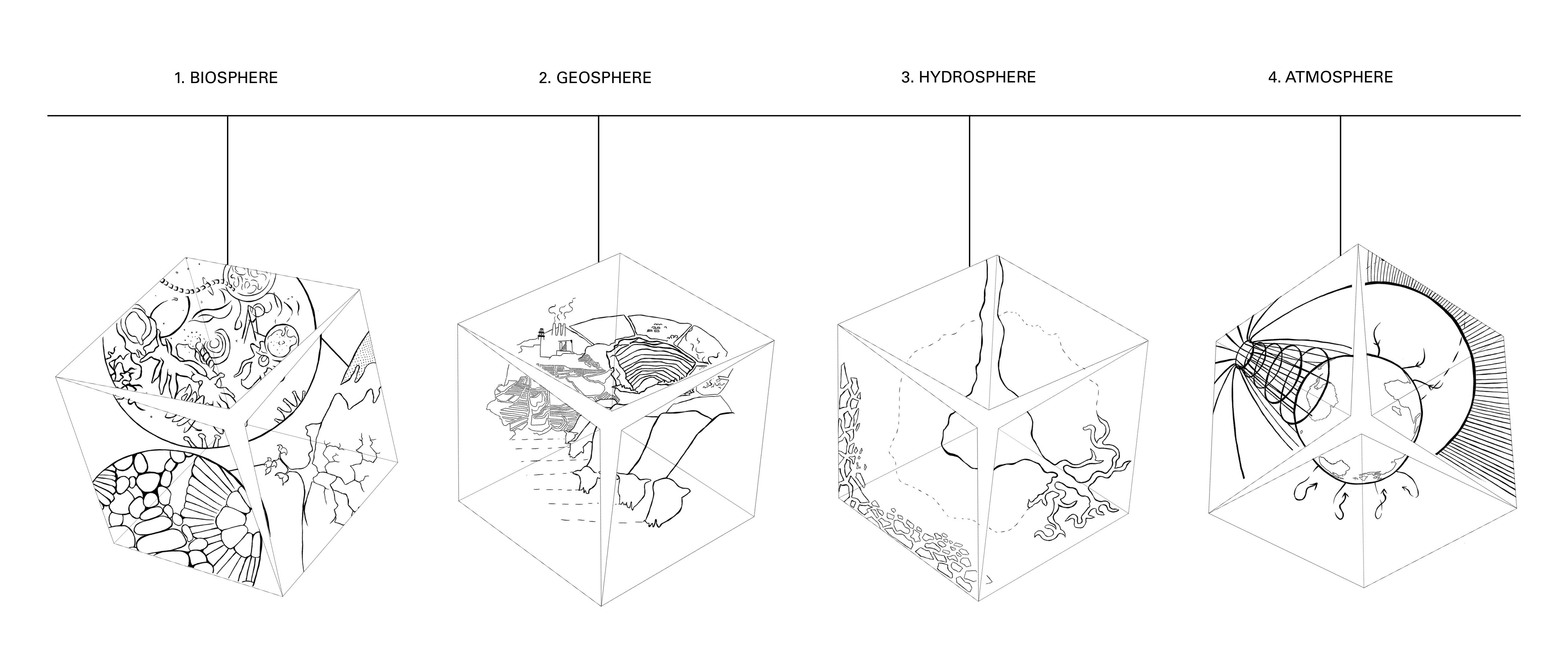
Our planet's network of living systems are destabilising. Addressing the climate emergency to a younger audience, I personified these these areas of ecological crisis into ‘Sleeping Giants & Weather Monsters’. My maps function as interactive worksheets that can be transformed into physical objects. In light of the pandemic, it can be alternatively explored in the form of augmented reality as you navigate through the Earth's spheres.
Worksheet / Foldable Globe / Augmented Reality
Our planet's network of living systems are destabilising. Addressing the climate emergency to a younger audience, I personified these these areas of ecological crisis into ‘Sleeping Giants & Weather Monsters’. My maps function as interactive worksheets that can be transformed into physical objects. In light of the pandemic, it can be alternatively explored in the form of augmented reality as you navigate through the Earth's spheres.
Greenland's Ice-sheet, West/ East Antartica, Artic Sea Ice, Amazon Rainforest, Boreal Forest, West African Monsoon, Indian Summer Monsoon, Warm Coral Reefs, Atlantic Circulation,
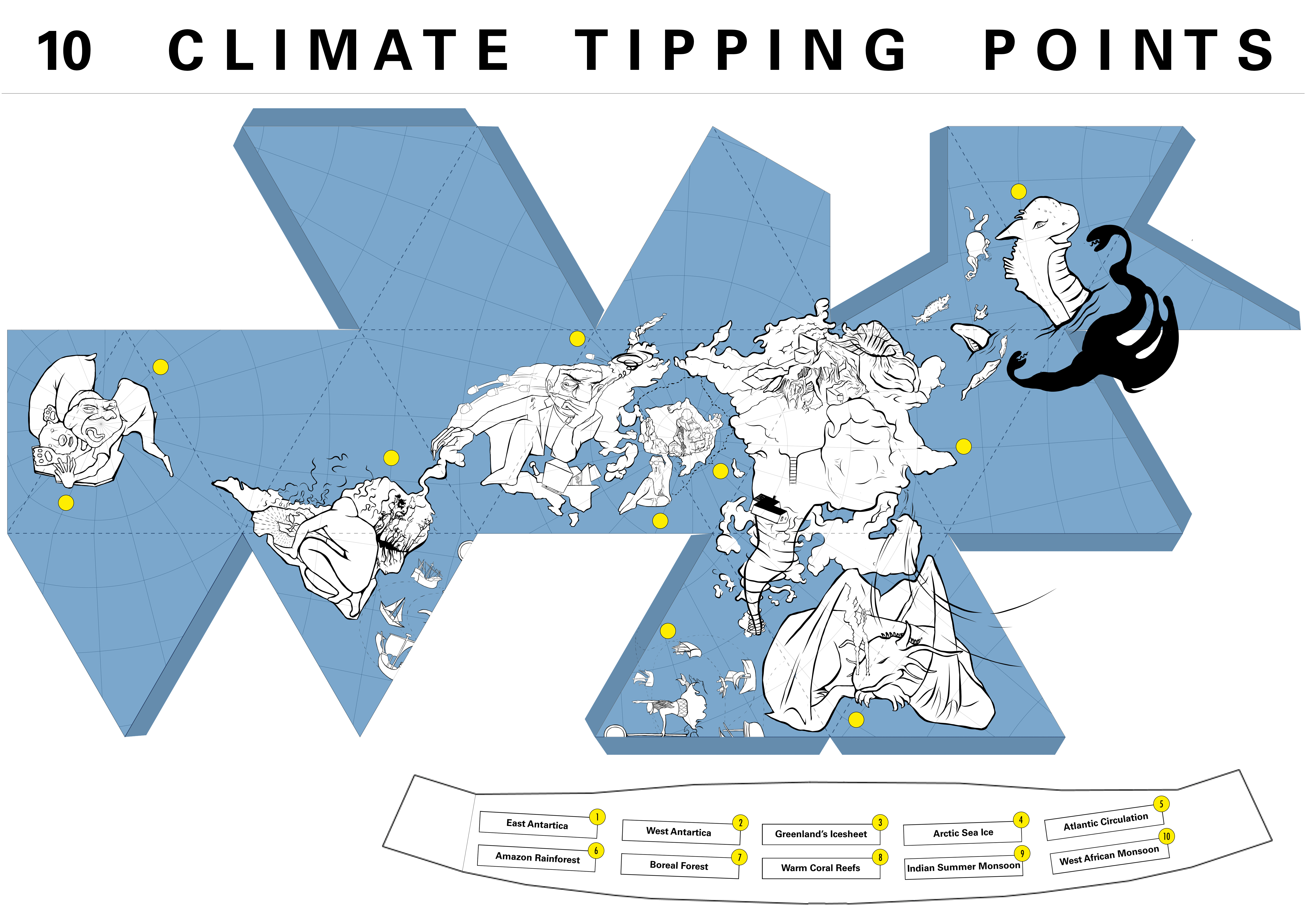


Prototyping - Hazardous Ordinance Map (Can be folded in 2048 ways and to make 2048 drawing combinations)